
This page is dedicated to the temperature departures/anomalies this winter. The temperature is often lost in the mix as the snow and rain storms become the reasons why people remember or forget winters. Below are images courtesy of WeatherBell, LLC (with the exception of the Mike's Snow Watch map).
December Temperatures:
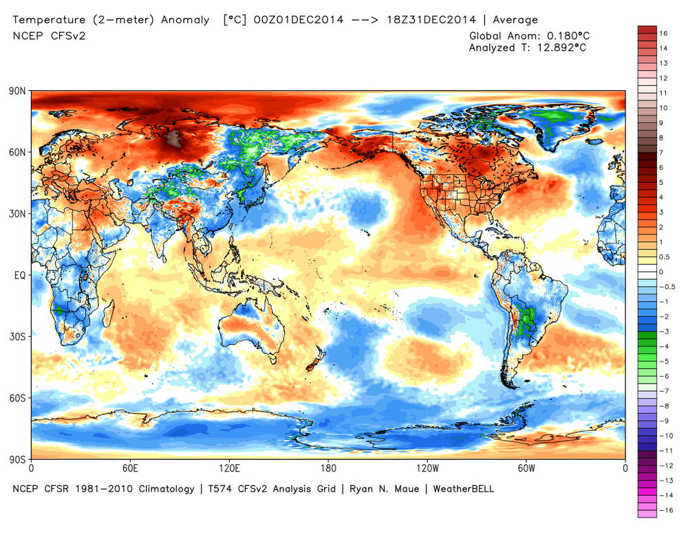
Most of the United States was warm in December. New Jersey was roughly 3 degrees above average, which was expected.
Current January Temperature Anomalies as of January 22, 2015:
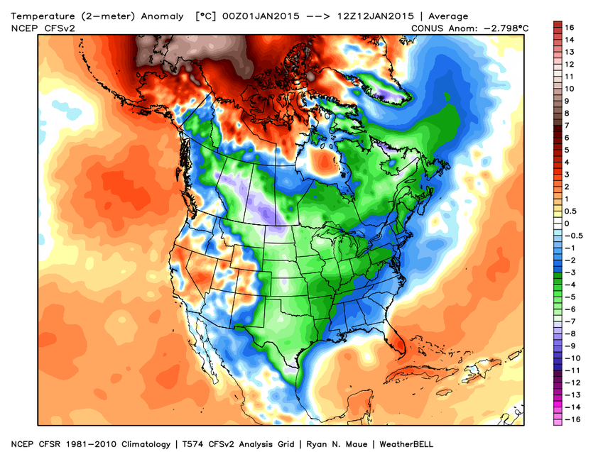
Frigid in most of the United States with the exception of the extreme southeast and parts of the west. New Jersey is currently around 5˚F below average. The US is currently about 5˚F degrees below average for January.
Predicted Temperature Anomalies From January 12-17:
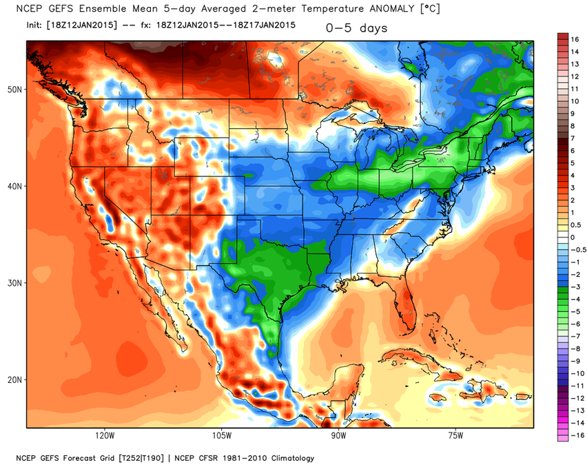
The brutal cold shifts east in the next five days as it warms in the west. The next five days are forecasted to be about 5 degrees below average in NJ. Notice how the cold is centered near the eastern central part of the country, which corresponds to our winter forecast. Also notice the corresponding warmth in the west (see below for winter forecast from October).
Predicted Temperature Anomalies From January 17-22:
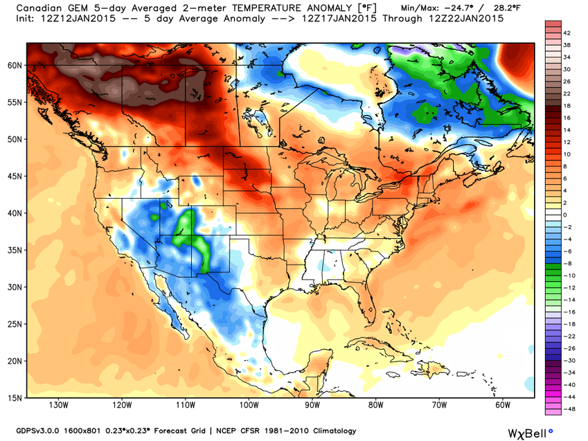
In the 6-11 day period, the cold dies out as slightly warm temperatures cover most of the United States. Cold develops in western areas. New Jersey is forecasted to be about 3˚F above average during this time period, bringing the monthly averages up a bit.
Mike's Snow Watch Winter Temperature Outlook From October:
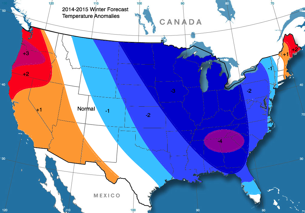
Long Range Outlook
The End of January:
After a brief warmup in the middle of the month--known as the infamous January Thaw--winter returns will almost as much power as the first half of January and more snow on into February.
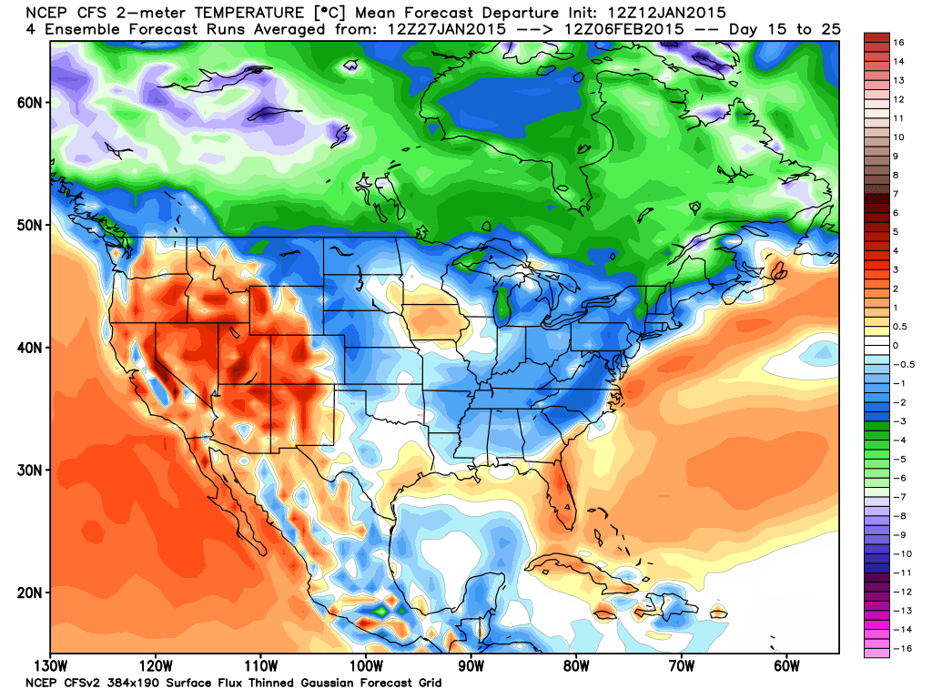
Below: Temperatures from January 27 through February 6 (New Jersey is forecasted to be about 4˚F below average during that 10-day period)
Below: Temperatures from January 27 through February 6 (New Jersey is forecasted to be about 4˚F below average during that 10-day period)
February:
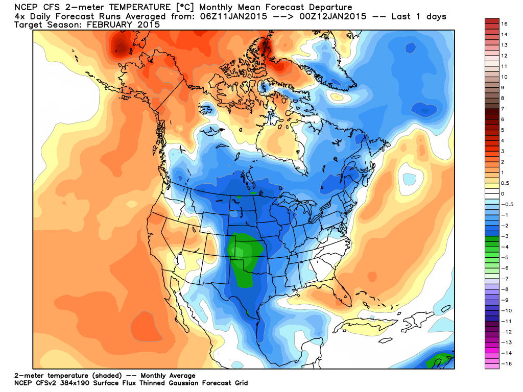
February is expected to be slightly colder than normal (1-2˚F is depicted here) with above average precipitation.
