Past Snowstorms
This new page will have archives of all past snow storms starting December 9, 2014 to see if the forecast was accurate for your area.
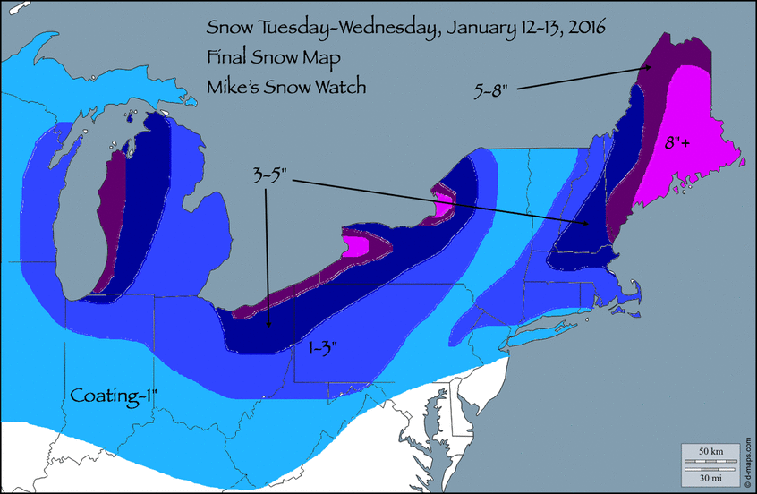
January 12, 2016
Summary: A shot of reinforcing cold air will arrive on Tuesday, January 12 with a small, cold storm known for producing a coating to a couple of inches of light, fluffy snow, called an Alberta Clipper.
Timing: Snow showers will arrive between 1PM and 3PM tomorrow and continue on and off until around 9PM. An Arctic Front will pass through the area around 8PM with a final round of snow and brutally cold air to follow. It will cause overnight lows on Tuesday in the low to mid teens, with temperatures not expected to reach 32 on Wednesday.
Detailed Analysis: Surface temperatures above freezing at the onset of the storm with 900MB and 850MB temperatures extremely cold at the onset of the storm causes a significant contrast in air particles. This contrast can cause instability and upward motion, allowing for snow bands to become hazardous from time to time. Depending upon where these bands set up, areas in the coating to one inch category may see up to an inch and a half, causing icy and dangerous travel conditions. More information will be posted about this particular aspect during the storm.
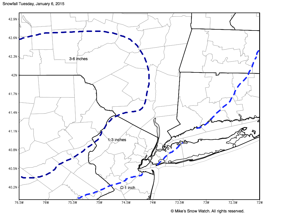
January 6, 2015
January 3-4, 2015

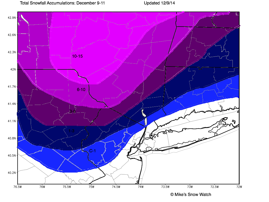
December 9-11, 2014
This nor'easter will bring heavy snow, rain, and a mix to the area this coming Tuesday and Wednesday. Accumulating snowfall is possible on the back end of the storm Wednesday late morning. Below are the totals for the entire storm.