2014-2015 Winter Forecast
This winter is expected to be chilly and wet with slightly above to above average snowfall. Although some say that this winter could rival last winter, it is more likely that it will be similar to the 2009-2010 and 2002-2003 winters. With a weak El Niño, the subtropical jet-stream will be active. Waves of low pressure that form near this jet-stream will combine with the polar jet-stream in the Gulf of Mexico or the Atlantic Ocean to form sizable snowstorms. One of the most important aspects of East Coast snowfall is East Coast water temperatures. Warmer temperatures allow more moisture to enter storms along the coast. This year so far, water temperatures are slightly above average.
This is the 2014-2015 Winter Temperature Outlook:
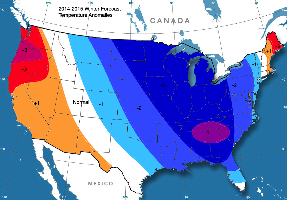
The temperature forecast has been derived from five analog years. Analog years are put together by sorting through years that were similar to this year so far (mostly in ocean temperatures), and their winters were blended together. The analogs are as follows: 1976-1977; 1977-1978; 2002-2003; 2009-2010; 2013-2014. 2009-2010 is being pinpointed as the most similar. Below are temperature blends of all five years and then 2009-2010 alone.

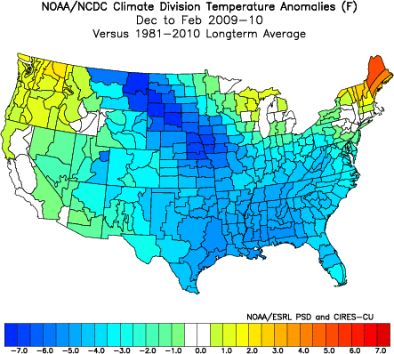
A seen above, the blend is very similar to our forecast, and the 2009-2010 map is only somewhat similar but has the same ideas (warmer in New England and the NW, core of cold in center of country).
This is the 2014-2015 Winter Precipitation Outlook:
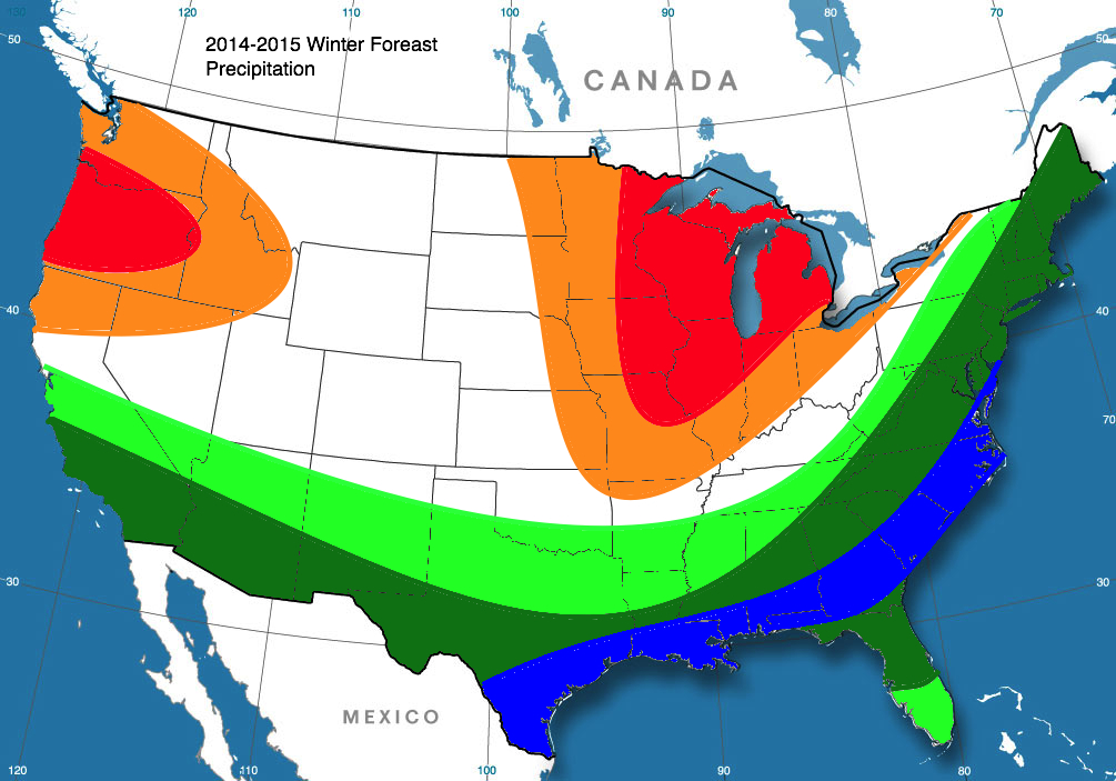
Using our same analogs, this map was developed, and overall, it looks similar to the analog blend shown below.
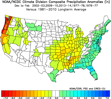
Below is the 2009-2010 winter precipitation (because again, it is the most similar analog):
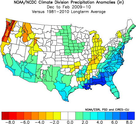
With the exception of the Iowa/Minnesota area, it again has very similar ideas to our forecast.
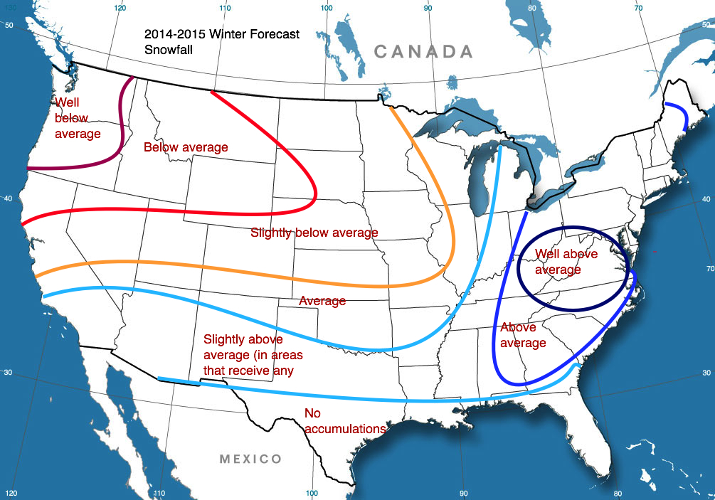
This year, expect temperatures to be 1-2 degrees below normal with above average precipitation mainly because of a weak El Niño that is forming. An El Niño is the increase in water temperatures off of the South American coast near the equator. Naturally, more heat means more evaporation, which it turn makes for more precipitation in the southern jet stream. Therefore, the southern and eastern part of the Unites States is predicted to be wet.
The middle half of December and Late January-Early February is pinpointed to be snowier and colder than other parts of the season.
Lastly is the 2014-2015 Winter Snowfall Outlook: